ROCKY RIVER... Tenterfield. NSW
Tenterfield, a small country town of around 4000 people lies 3 hours south west of Brisbane on the New England Tablelands, sitting just below the magic 1000 metres above sea level mark. With winters that often get below freezing with snow falls, yet the summers can be pretty warm, its one of those small unique country towns that you really don't think too much of when passing through. Although this quiet country town does hold a significant part in Australia's history that dates back 180 years. In 1827 settlers were pushing south after exploring the Darling Downs discovering this region across the border from Queensland, thus leading to settlement and further exploration to where Tenterfield sits today.Tenterfield and its surrounding areas soon became known for its fine class wool with large stations, and with its increasing growth came development with hotels, a police station and a court house. With all this moving forward and development, a link was made to the coast to ship the Tablelands wool and to resupply the tablelands with other goods. It was reported that it could take some 4 months to complete the journey with a large bullock team.
50km away to the east, gold and other minerals were soon found in several areas that included Rocky River, Morgans Gully and the Timbarra Plateau, and with the influx of miners the settlement of Drake was established. Now we all know that with the discovery of any precious metal back in that period, the obvious would soon follow. Bushrangers !!. The most famous bushranger that scouted these areas was Captain Thunderbolt aka Fred Ward. It is reported that he roamed from the Hunter valley in the south to the Queensland border, robbing travellers, hotels and stores.
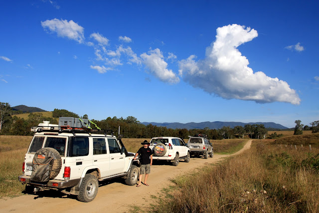
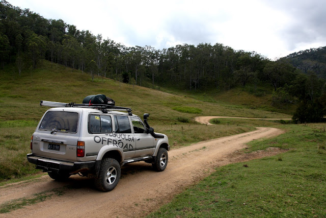
The Rocky River trip starts from the heart of Tenterfield as you wander east down the aptly named Scrub Road then into Billirimba Road. With long straight tree lined sections of dirt you can gaze across the paddocks with views towards the mountains in the distance, definitely views to die for. Old buildings now abandon, machinery rusting away lay quietly in the paddocks from years gone by.
With Quilgeran Pinnacle to your right and Black Mountain to your left you feel pretty small as you follow the road as it snakes through the terrain. Soon you pass through the locality of Steinbrook, not much anymore, just a big kink in the road with several 90 degree corners. Just out of town the dirt continues as you cross the Cataract River, here you are greeted with stunning views across fertile farmlands, with mountain peaks in the distance- the views are just that good. For the next 15km the road follows several ridge lines before dropping down to fertile valley flats. Now you begin to pass through several private cattle stations. The owners like you to stick to the established station roads but there are pull over spots on higher ground which are great for photos and to take in the surrounding views. Give respect to any farmers you may see out here with a friendly wave and slow right down as they don't appreciate the dust or noise that might spook their livestock.
It is hard to believe that you are now at just 350 metres above sea level after dropping down 500 metres in just several kilometres. After heavy rain the water from the above ridges starts to gather in these valleys to form the Rocky River, and at times flooding onto the nearby paddocks leaving good fertile soil from the hills above creating lush grazing flats for the livestock.
At the 40 km mark an intersection will appear with a couple of options. With a right hand turn here along Upper Rocky river Road you can explore other reaches of these valleys and Rocky River. Now the trail here goes for another 30 km with creek crossings into some rugged areas, it does come to a dead end. It is possible to camp along the way but you will need prior permission to do this, unfortunately you need to wander back to this intersection for another adventure decision. Our decision was to go straight on, sign posted towards Drake ( 53km away).
It's around here that phone reception will soon disappear and hopefully the kids will jump off Facebook ,stop texting, and wind the windows down to be part of this great adventure with you. With a single lane low level bridge in sight, the head waters of this little waterway is one of many that flows down from the range above you from your left into the Rocky River. It was the centre of a major gold mine debacle. The Timbarra Gold Mine attracted attention from around the world in the early nineties when it was realised that the risk of pollution towards the Clarence River System could have major impact due to the areas high rainfall. The risk was due to unstable cyanide heaps that could leech into the nearby creeks and rivers, threatening pristine forests, waterway life and local wildlife species. After several overflows from cyanide ponds the mine was finally closed.
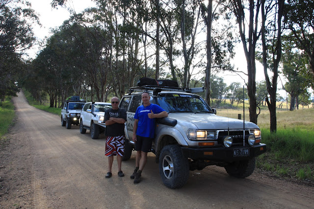
Some may find it hard to believe but this road was once the main route between Tenterfield, Drake then through to Lionsville ( now an abandoned gold mine settlement ) and on towards Grafton over 100 years ago. From the old Cobb and Co Coaches, large bullock teams and even bushrangers they all used this road. Back in the day, early settlers simply could not move these granite boulders that in some case are as large as a double decker bus, you'll even have to sound your horn as you approach some of these rocks as it is a near zig zag around a section here, pretty interesting if towing a camper trailer through here.
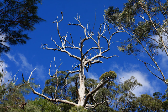
As the road follows the river keep an eye out for the odd wallaby or rabbit that needs to be across the other side of the road ( as they do !!) as the undergrowth along here is thick, holds plenty of hiding spaces and nutrients for them. An added bonus when travelling here is the amount of birdlife you may see beside the river- from shags, parrots, kingfishers to the common old crow. The river is the lifeline of this area, providing food for animals, water for the livestock and plants, as well as nutrients for the adjoining paddocks when the river floods. The roads out here are typical of the old Cobb & Co run roads. Twisting its way around the granite boulders, towards the river and away again. This was to give the stage coach a fairly flat, level and stable ride for those on board. Still would of been rough tumbling along.
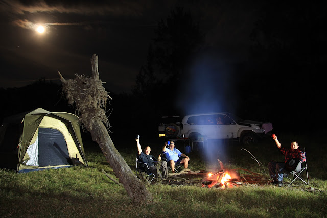
There are several areas along here on the right beside the river where camping is not allowed but it is sign posted for all to see. At the 15km mark a huge grassed area off to your right that has several tracks leading down to some great flat areas are welcoming camp areas. It is a great option to pop across the road to the farmers house just to make sure you have the right one and permission, nothing wrong with a bit of common country courtesy. Payment here is generally a box of cans marked only with four x's !!. There are no facilities here but if you approach the station owner they will guide you in the direction of some great timber that you are welcome to cut up and carry down for a riverside fire. Camping under the old Casurina Trees is pretty special here as the water flows past. Don't forget to throw a rod in and either team it up with some old meat for a chance to snag a freshwater Yabby or a Fork Tail Catfish for dinner. Being self sufficient here also means supplying and disposing of all toiletries and taking your rubbish away, nothing wrong with taking out what you bought in. Night time brings out Owls, the occasional Bat, frogs start croaking and if you sit still long enough and scan the grounds with a torch you may see the occasional Possum. If you are a keen punter and the weather is right, swimming in the Rocky River is pure bliss. Clean fresh water that has filtered through granite particles definitely leaves you feeling relaxed and clean. This is the life.
Whether staying for one night or several have a scout around for any rubbish that may have been left behind, this keeps the area pristine and makes for a happy farmer for us to return. Leaving camp behind Rocky River Road snakes its way past more working stations crossing into new properties, rising and falling beside Rocky River. As you wander along, keep an eye out for the amount of debris in the form of branches and logs that have been caught high in the trees in past floods. Floods out here can flow quite fast, evident by the angle of the trees that are trying to grow beside the river. There is nothing too difficult about this road that any 4wd can undertake, for added safety why not choose 4wd high. This will give you some added traction on these granite based roads that can be slippery at times or to avoid an animal that suddenly appears. With several small causeway crossings just be aware of the slippery surface or the water depth, most of the time they should be ok. Soon the cleared country farmlands turn to a thicker growth as you veer away from the river and into the hills. Tall timber sections covered with vines and small hobby farms lead the way as the elevation will soon rise, this is where the road changes into Long Gully Road.
Here as you enter Girard State Forest the terrain gets a bit more serious and the road rises to near 1000 metres above sea level in a few kilometres. Being on the southern side of this range, the rainforest is stunning and is generally a bit cooler than the flats below. With tall cool climate ferns, palms and even the odd coachwood tree is a totally different eco system to what you have just left behind. Even the wildlife has changed to the sounds of whip-birds, the odd paddy melon wallaby hiding road side to the ever popular carpet python snaking its way roadside. For those who want to explore Girard Forest, keep an eye out for Long Gully Fire Trail on the right. These trails are great to explore the top of the range, passing through large stands of scrubby timber that contains iron bark, black butt and a little scribbly gum. The trails in here do loop around back to where you start from, so getting lost isn't really a worry OR an option. You will find stands of Grass Trees, old log bridges and several rutty hills where 4wd will be needed. The trails in the Girard State Forest are maintained on a irregular basis so care must be taken, as you may encounter the odd tree that has fallen. Returning back to Long Gully Road it is a matter of swinging right and adjoining the tar again, The houses seem to get closer and closer to each other and you know a town is not too far away. Not long the Bruxner Highway greets you and it is here you need to decide whether it is a short dash to your left into the town of Drake for a counter meal, or do you head to your right for a run down towards the coast. Options are great !!


No comments:
Post a Comment